


20190827-Lyons la Foret Version Courte

doudet
User
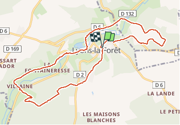

Length
11.1 km

Max alt
185 m

Uphill gradient
220 m
Km-Effort
14 km

Min alt
72 m

Downhill gradient
216 m
Boucle
Yes
Creation date :
2019-08-27 12:10:36.752
Updated on :
2019-08-28 06:08:44.274
3h08
Difficulty : Medium

FREE GPS app for hiking
 SityTrail
IGN / Geographical institutes
SityTrail Plus
The world is yours!
About
Trail Walking of 11.1 km to be discovered at Normandy, Eure, Lyons-la-Forêt. This trail is proposed by doudet.
Description
Boucle A-R au départ deu Parking des Sapeurs Pompiers
Positioning
Country:
France
Region :
Normandy
Department/Province :
Eure
Municipality :
Lyons-la-Forêt
Location:
Unknown
Start:(Dec)
Start:(UTM)
389646 ; 5472970 (31U) N.
Comments