


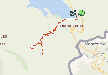
Mont-Cenis : Fort de Malamot et Lac Blanc

manumax
User

Length
24 km

Max alt
2897 m

Uphill gradient
1009 m
Km-Effort
37 km

Min alt
1956 m

Downhill gradient
1008 m
Boucle
Yes
Creation date :
2019-08-28 19:43:29.138
Updated on :
2019-08-28 20:01:20.756
--
Difficulty : Very difficult

FREE GPS app for hiking
 SityTrail
IGN / Geographical institutes
SityTrail Plus
The world is yours!
About
Trail Walking of 24 km to be discovered at Auvergne-Rhône-Alpes, Savoy, Val-Cenis. This trail is proposed by manumax.
Positioning
Country:
France
Region :
Auvergne-Rhône-Alpes
Department/Province :
Savoy
Municipality :
Val-Cenis
Location:
Lanslebourg-Mont-Cenis
Start:(Dec)
Start:(UTM)
340030 ; 5009949 (32T) N.
Comments