


Refuge Valmasque, fontanalbe

domi06
User
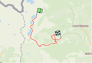

Length
11.2 km

Max alt
2570 m

Uphill gradient
551 m
Km-Effort
19.2 km

Min alt
2013 m

Downhill gradient
744 m
Boucle
No
Creation date :
2019-08-22 06:56:27.863
Updated on :
2019-08-30 14:57:58.176
6h51
Difficulty : Medium

FREE GPS app for hiking
 SityTrail
IGN / Geographical institutes
SityTrail Plus
The world is yours!
About
Trail Walking of 11.2 km to be discovered at Provence-Alpes-Côte d'Azur, Maritime Alps, Tende. This trail is proposed by domi06.
Description
Baisse Fontanalbe. Lac vert, voie sacrée.
Photos


Positioning
Country:
France
Region :
Provence-Alpes-Côte d'Azur
Department/Province :
Maritime Alps
Municipality :
Tende
Location:
Unknown
Start:(Dec)
Start:(UTM)
375711 ; 4885059 (32T) N.
Comments