


1

olivier26
User
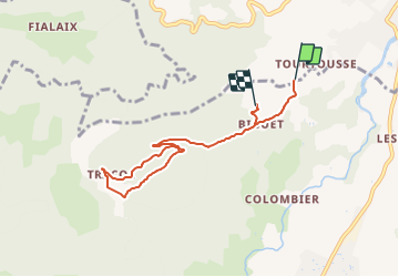

Length
7.4 km

Max alt
444 m

Uphill gradient
308 m
Km-Effort
11.3 km

Min alt
158 m

Downhill gradient
245 m
Boucle
No
Creation date :
2014-12-10 00:00:00.0
Updated on :
2014-12-10 00:00:00.0
10m
Difficulty : Unknown

FREE GPS app for hiking
 SityTrail
IGN / Geographical institutes
SityTrail Plus
The world is yours!
About
Trail Other activity of 7.4 km to be discovered at Auvergne-Rhône-Alpes, Ardèche, Saint-Péray. This trail is proposed by olivier26.
Positioning
Country:
France
Region :
Auvergne-Rhône-Alpes
Department/Province :
Ardèche
Municipality :
Saint-Péray
Location:
Unknown
Start:(Dec)
Start:(UTM)
643258 ; 4975966 (31T) N.
Comments