


Tartas

Spinnaker
User
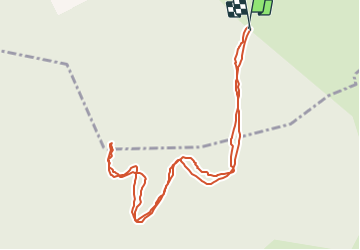

Length
1.4 km

Max alt
1337 m

Uphill gradient
81 m
Km-Effort
2.5 km

Min alt
1248 m

Downhill gradient
81 m
Boucle
Yes
Creation date :
2019-09-01 14:07:11.652
Updated on :
2019-09-01 14:39:51.911
32m
Difficulty : Very easy

FREE GPS app for hiking
 SityTrail
IGN / Geographical institutes
SityTrail Plus
The world is yours!
About
Trail Walking of 1.4 km to be discovered at Auvergne-Rhône-Alpes, Haute-Loire, Saint-Arcons-de-Barges. This trail is proposed by Spinnaker.
Positioning
Country:
France
Region :
Auvergne-Rhône-Alpes
Department/Province :
Haute-Loire
Municipality :
Saint-Arcons-de-Barges
Location:
Unknown
Start:(Dec)
Start:(UTM)
571410 ; 4962697 (31T) N.
Comments