


OISSEL

hugonemo
User

Length
12.6 km

Max alt
135 m

Uphill gradient
232 m
Km-Effort
15.7 km

Min alt
2 m

Downhill gradient
231 m
Boucle
Yes
Creation date :
2019-09-02 09:58:06.307
Updated on :
2019-09-02 10:04:28.273
--
Difficulty : Medium

FREE GPS app for hiking
 SityTrail
IGN / Geographical institutes
SityTrail Plus
The world is yours!
About
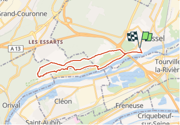
Trail Walking of 12.6 km to be discovered at Normandy, Seine-Maritime, Oissel. This trail is proposed by hugonemo.
Description
départ parking du chateau Oissel 13km
Positioning
Country:
France
Region :
Normandy
Department/Province :
Seine-Maritime
Municipality :
Oissel
Location:
Unknown
Start:(Dec)
Start:(UTM)
360952 ; 5466814 (31U) N.
Comments