


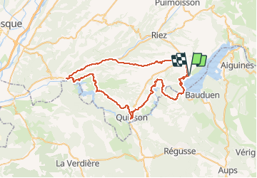
Les lacs du Verdon

PhilippeC54
User

Length
69 km

Max alt
650 m

Uphill gradient
1315 m
Km-Effort
87 km

Min alt
311 m

Downhill gradient
1315 m
Boucle
Yes
Creation date :
2019-09-02 06:41:12.877
Updated on :
2019-09-02 11:57:42.035
4h33
Difficulty : Medium

FREE GPS app for hiking
 SityTrail
IGN / Geographical institutes
SityTrail Plus
The world is yours!
About
Trail Road bike of 69 km to be discovered at Provence-Alpes-Côte d'Azur, Alpes-de-Haute-Provence, Sainte-Croix-du-Verdon. This trail is proposed by PhilippeC54.
Positioning
Country:
France
Region :
Provence-Alpes-Côte d'Azur
Department/Province :
Alpes-de-Haute-Provence
Municipality :
Sainte-Croix-du-Verdon
Location:
Unknown
Start:(Dec)
Start:(UTM)
270641 ; 4849241 (32T) N.
Comments