


Régordane 4 - Albespeyre-Génolhac

nolsim
User
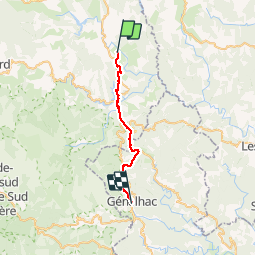

Length
24 km

Max alt
893 m

Uphill gradient
543 m
Km-Effort
32 km

Min alt
431 m

Downhill gradient
930 m
Boucle
No
Creation date :
2019-09-02 06:13:38.707
Updated on :
2019-09-02 13:58:05.007
7h43
Difficulty : Difficult

FREE GPS app for hiking
 SityTrail
IGN / Geographical institutes
SityTrail Plus
The world is yours!
About
Trail Walking of 24 km to be discovered at Occitania, Lozère, Prévenchères. This trail is proposed by nolsim.
Description
Quelques bonnes côtes. Un peu trop de goudron
Photos


Positioning
Country:
France
Region :
Occitania
Department/Province :
Lozère
Municipality :
Prévenchères
Location:
Unknown
Start:(Dec)
Start:(UTM)
573921 ; 4927492 (31T) N.
Comments