


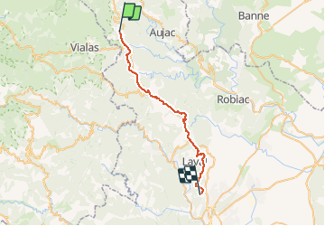
Régordane 5 - Génolhac-Drulhes

nolsim
User

Length
32 km

Max alt
563 m

Uphill gradient
628 m
Km-Effort
41 km

Min alt
234 m

Downhill gradient
888 m
Boucle
No
Creation date :
2019-09-03 06:04:35.478
Updated on :
2019-09-03 15:07:14.668
9h01
Difficulty : Difficult

FREE GPS app for hiking
 SityTrail
IGN / Geographical institutes
SityTrail Plus
The world is yours!
About
Trail Walking of 32 km to be discovered at Occitania, Gard, Génolhac. This trail is proposed by nolsim.
Description
Quelques beaux chemins mais beaucoup de goudron. Passage par les mines
Photos


Positioning
Country:
France
Region :
Occitania
Department/Province :
Gard
Municipality :
Génolhac
Location:
Unknown
Start:(Dec)
Start:(UTM)
575735 ; 4911189 (31T) N.
Comments