


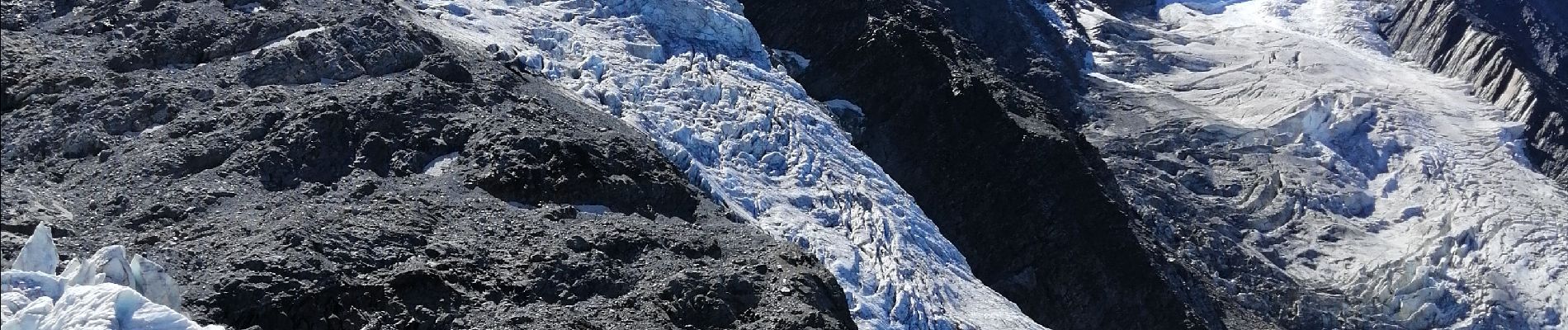
Glaciers des Bossons

domi06
User
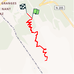

Length
11.2 km

Max alt
2575 m

Uphill gradient
1225 m
Km-Effort
28 km

Min alt
1226 m

Downhill gradient
1399 m
Boucle
No
Creation date :
2019-09-03 07:20:57.285
Updated on :
2019-09-09 09:22:23.039
7h54
Difficulty : Difficult

FREE GPS app for hiking
 SityTrail
IGN / Geographical institutes
SityTrail Plus
The world is yours!
About
Trail Walking of 11.2 km to be discovered at Auvergne-Rhône-Alpes, Upper Savoy, Chamonix-Mont-Blanc. This trail is proposed by domi06.
Photos


Positioning
Country:
France
Region :
Auvergne-Rhône-Alpes
Department/Province :
Upper Savoy
Municipality :
Chamonix-Mont-Blanc
Location:
Unknown
Start:(Dec)
Start:(UTM)
333144 ; 5084562 (32T) N.
Comments