


lacs saint Anne, Miroir et Ruite en boucle

PEBREJOSIANE
User

Length
13.9 km

Max alt
2413 m

Uphill gradient
803 m
Km-Effort
25 km

Min alt
1816 m

Downhill gradient
800 m
Boucle
Yes
Creation date :
2019-09-04 07:34:03.973
Updated on :
2019-09-04 15:12:37.282
6h40
Difficulty : Medium

FREE GPS app for hiking
 SityTrail
IGN / Geographical institutes
SityTrail Plus
The world is yours!
About
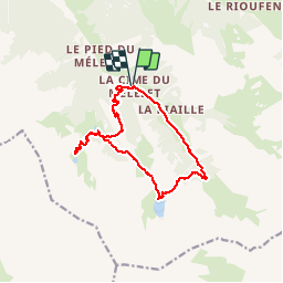
Trail Walking of 13.9 km to be discovered at Provence-Alpes-Côte d'Azur, Hautes-Alpes, Ceillac. This trail is proposed by PEBREJOSIANE.
Positioning
Country:
France
Region :
Provence-Alpes-Côte d'Azur
Department/Province :
Hautes-Alpes
Municipality :
Ceillac
Location:
Unknown
Start:(Dec)
Start:(UTM)
325808 ; 4945781 (32T) N.
Comments