


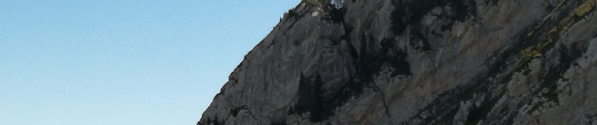
TOUR DE L'AIGUILLE DE SERRAVAL

Jean-Paulchoux
User
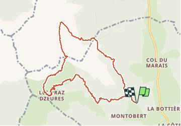

Length
11.3 km

Max alt
1833 m

Uphill gradient
967 m
Km-Effort
24 km

Min alt
1025 m

Downhill gradient
968 m
Boucle
Yes
Creation date :
2019-09-04 06:30:53.523
Updated on :
2019-11-03 13:49:45.677
5h24
Difficulty : Medium

FREE GPS app for hiking
 SityTrail
IGN / Geographical institutes
SityTrail Plus
The world is yours!
About
Trail Walking of 11.3 km to be discovered at Auvergne-Rhône-Alpes, Upper Savoy, Serraval. This trail is proposed by Jean-Paulchoux.
Photos


Positioning
Country:
France
Region :
Auvergne-Rhône-Alpes
Department/Province :
Upper Savoy
Municipality :
Serraval
Location:
Unknown
Start:(Dec)
Start:(UTM)
292393 ; 5076805 (32T) N.
Comments