


Régordane 7 - Vézénobre-Ste Anastasie

nolsim
User
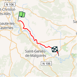

Length
26 km

Max alt
187 m

Uphill gradient
274 m
Km-Effort
30 km

Min alt
62 m

Downhill gradient
380 m
Boucle
No
Creation date :
2019-09-05 06:00:43.281
Updated on :
2019-09-05 12:53:09.751
6h51
Difficulty : Medium

FREE GPS app for hiking
 SityTrail
IGN / Geographical institutes
SityTrail Plus
The world is yours!
About
Trail Walking of 26 km to be discovered at Occitania, Gard, Vézénobres. This trail is proposed by nolsim.
Description
Chemins plats dans les vignes
Photos


Positioning
Country:
France
Region :
Occitania
Department/Province :
Gard
Municipality :
Vézénobres
Location:
Unknown
Start:(Dec)
Start:(UTM)
591030 ; 4878337 (31T) N.
Comments