


La Grande Lance de Domène

alinetpierre
User
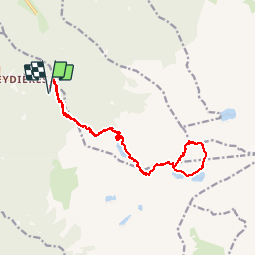

Length
18.3 km

Max alt
2764 m

Uphill gradient
1440 m
Km-Effort
37 km

Min alt
1358 m

Downhill gradient
1437 m
Boucle
Yes
Creation date :
2019-09-06 05:43:28.0
Updated on :
2019-09-06 17:34:16.998
8h33
Difficulty : Very difficult

FREE GPS app for hiking
 SityTrail
IGN / Geographical institutes
SityTrail Plus
The world is yours!
About
Trail Walking of 18.3 km to be discovered at Auvergne-Rhône-Alpes, Isère, Revel. This trail is proposed by alinetpierre.
Description
Difficile
Positioning
Country:
France
Region :
Auvergne-Rhône-Alpes
Department/Province :
Isère
Municipality :
Revel
Location:
Unknown
Start:(Dec)
Start:(UTM)
728712 ; 5007439 (31T) N.
Comments