


7.9.2019Marcinelle

fra_depoorter
User
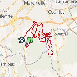

Length
19.8 km

Max alt
211 m

Uphill gradient
369 m
Km-Effort
25 km

Min alt
122 m

Downhill gradient
370 m
Boucle
Yes
Creation date :
2019-09-07 07:39:02.033
Updated on :
2019-09-07 17:34:26.413
4h37
Difficulty : Easy

FREE GPS app for hiking
 SityTrail
IGN / Geographical institutes
SityTrail Plus
The world is yours!
About
Trail Walking of 19.8 km to be discovered at Wallonia, Hainaut, Charleroi. This trail is proposed by fra_depoorter.
Positioning
Country:
Belgium
Region :
Wallonia
Department/Province :
Hainaut
Municipality :
Charleroi
Location:
Marcinelle
Start:(Dec)
Start:(UTM)
602012 ; 5580270 (31U) N.
Comments