


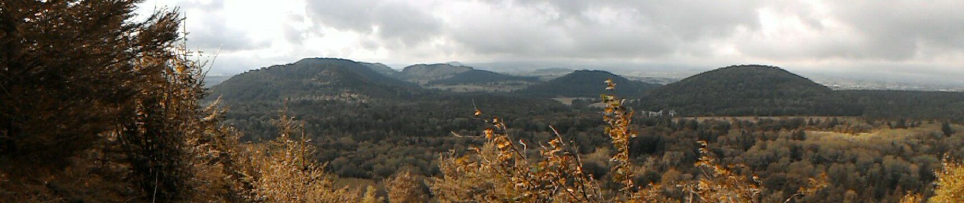
2019-09-08 Puy de la vache

jacq58
User
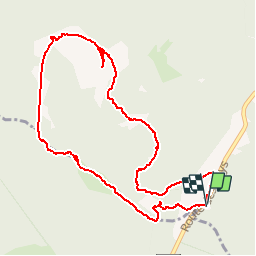

Length
5.4 km

Max alt
1174 m

Uphill gradient
250 m
Km-Effort
8.7 km

Min alt
984 m

Downhill gradient
252 m
Boucle
Yes
Creation date :
2019-09-08 08:07:41.377
Updated on :
2019-09-08 15:19:02.272
2h21
Difficulty : Medium

FREE GPS app for hiking
 SityTrail
IGN / Geographical institutes
SityTrail Plus
The world is yours!
About
Trail Walking of 5.4 km to be discovered at Auvergne-Rhône-Alpes, Puy-de-Dôme, Saint-Genès-Champanelle. This trail is proposed by jacq58.
Description
boucle à partir du parking
Photos


Positioning
Country:
France
Region :
Auvergne-Rhône-Alpes
Department/Province :
Puy-de-Dôme
Municipality :
Saint-Genès-Champanelle
Location:
Unknown
Start:(Dec)
Start:(UTM)
497471 ; 5060893 (31T) N.
Comments