


col de merle bouteillac

raab
User
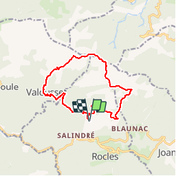

Length
14.5 km

Max alt
1201 m

Uphill gradient
832 m
Km-Effort
26 km

Min alt
500 m

Downhill gradient
830 m
Boucle
Yes
Creation date :
2019-09-05 07:45:52.041
Updated on :
2019-09-09 10:47:46.377
8h09
Difficulty : Difficult

FREE GPS app for hiking
 SityTrail
IGN / Geographical institutes
SityTrail Plus
The world is yours!
About
Trail Walking of 14.5 km to be discovered at Auvergne-Rhône-Alpes, Ardèche, Rocles. This trail is proposed by raab.
Positioning
Country:
France
Region :
Auvergne-Rhône-Alpes
Department/Province :
Ardèche
Municipality :
Rocles
Location:
Unknown
Start:(Dec)
Start:(UTM)
595956 ; 4936553 (31T) N.
Comments