


sentier des vignerons lablachere

raab
User

Length
8.4 km

Max alt
366 m

Uphill gradient
168 m
Km-Effort
10.6 km

Min alt
236 m

Downhill gradient
165 m
Boucle
Yes
Creation date :
2019-09-11 12:29:26.627
Updated on :
2019-09-11 15:33:05.584
2h51
Difficulty : Easy

FREE GPS app for hiking
 SityTrail
IGN / Geographical institutes
SityTrail Plus
The world is yours!
About
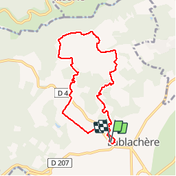
Trail Walking of 8.4 km to be discovered at Auvergne-Rhône-Alpes, Ardèche, Lablachère. This trail is proposed by raab.
Positioning
Country:
France
Region :
Auvergne-Rhône-Alpes
Department/Province :
Ardèche
Municipality :
Lablachère
Location:
Unknown
Start:(Dec)
Start:(UTM)
596238 ; 4924225 (31T) N.
Comments