


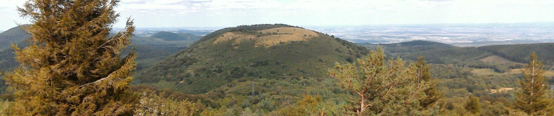
2019-09-10 - puy de pariou

jacq58
User
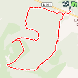

Length
6.3 km

Max alt
1179 m

Uphill gradient
222 m
Km-Effort
9.3 km

Min alt
966 m

Downhill gradient
221 m
Boucle
Yes
Creation date :
2019-09-10 11:15:56.316
Updated on :
2019-09-11 17:12:02.356
2h47
Difficulty : Easy

FREE GPS app for hiking
 SityTrail
IGN / Geographical institutes
SityTrail Plus
The world is yours!
About
Trail Walking of 6.3 km to be discovered at Auvergne-Rhône-Alpes, Puy-de-Dôme, Orcines. This trail is proposed by jacq58.
Description
boucle bien balisé, balade agréable.
Photos


Positioning
Country:
France
Region :
Auvergne-Rhône-Alpes
Department/Province :
Puy-de-Dôme
Municipality :
Orcines
Location:
Unknown
Start:(Dec)
Start:(UTM)
498969 ; 5072266 (31T) N.
Comments