


CLECYU-19 16:39:48

UDGI54
User
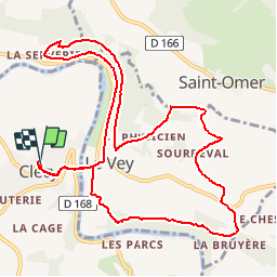

Length
11.6 km

Max alt
248 m

Uphill gradient
425 m
Km-Effort
17.2 km

Min alt
32 m

Downhill gradient
425 m
Boucle
Yes
Creation date :
2019-09-13 10:10:34.521
Updated on :
2019-09-13 10:11:55.784
3h35
Difficulty : Difficult

FREE GPS app for hiking
 SityTrail
IGN / Geographical institutes
SityTrail Plus
The world is yours!
About
Trail Walking of 11.6 km to be discovered at Normandy, Calvados, Clécy. This trail is proposed by UDGI54.
Positioning
Country:
France
Region :
Normandy
Department/Province :
Calvados
Municipality :
Clécy
Location:
Unknown
Start:(Dec)
Start:(UTM)
684472 ; 5421309 (30U) N.
Comments