


rocher de la Davie

whisper73
User
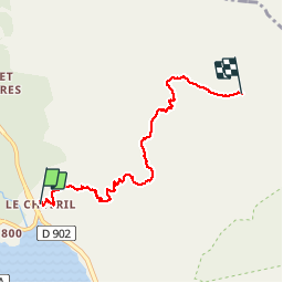

Length
5.7 km

Max alt
3143 m

Uphill gradient
1294 m
Km-Effort
18.6 km

Min alt
1829 m

Downhill gradient
1 m
Boucle
No
Creation date :
2019-09-14 05:22:12.606
Updated on :
2019-09-14 18:49:38.802
2h39
Difficulty : Medium
20m
Difficulty : Medium

FREE GPS app for hiking
 SityTrail
IGN / Geographical institutes
SityTrail Plus
The world is yours!
About
Trail Walking of 5.7 km to be discovered at Auvergne-Rhône-Alpes, Savoy, Tignes. This trail is proposed by whisper73.
Description
superbe rando vol parapente
Positioning
Country:
France
Region :
Auvergne-Rhône-Alpes
Department/Province :
Savoy
Municipality :
Tignes
Location:
Unknown
Start:(Dec)
Start:(UTM)
338570 ; 5040308 (32T) N.
Comments