


69620Ternand_coeur-190911

adye
User
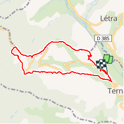

Length
8.4 km

Max alt
651 m

Uphill gradient
380 m
Km-Effort
13.4 km

Min alt
319 m

Downhill gradient
384 m
Boucle
No
Creation date :
2019-09-11 12:31:28.846
Updated on :
2019-09-14 09:43:41.698
2h17
Difficulty : Difficult

FREE GPS app for hiking
 SityTrail
IGN / Geographical institutes
SityTrail Plus
The world is yours!
About
Trail Walking of 8.4 km to be discovered at Auvergne-Rhône-Alpes, Rhône, Ternand. This trail is proposed by adye.
Description
Départ du cimetière, les Charmettes, Crêt Verrière (juste au-dessus du "cœur de Milhomme", puis terrain de cross), le Giraud, St-Victor.
Positioning
Country:
France
Region :
Auvergne-Rhône-Alpes
Department/Province :
Rhône
Municipality :
Ternand
Location:
Unknown
Start:(Dec)
Start:(UTM)
617931 ; 5089536 (31T) N.
Comments