


rabat murol

Coux
User
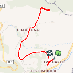

Length
5.9 km

Max alt
975 m

Uphill gradient
173 m
Km-Effort
8.2 km

Min alt
819 m

Downhill gradient
173 m
Boucle
Yes
Creation date :
2019-09-14 14:10:17.076
Updated on :
2019-09-14 15:34:54.329
1h22
Difficulty : Easy

FREE GPS app for hiking
 SityTrail
IGN / Geographical institutes
SityTrail Plus
The world is yours!
About
Trail Walking of 5.9 km to be discovered at Auvergne-Rhône-Alpes, Puy-de-Dôme, Murol. This trail is proposed by Coux.
Positioning
Country:
France
Region :
Auvergne-Rhône-Alpes
Department/Province :
Puy-de-Dôme
Municipality :
Murol
Location:
Unknown
Start:(Dec)
Start:(UTM)
496239 ; 5047278 (31T) N.
Comments