


2019-09-12 - Puy des Gouttes - Puy Chopine -Puy Coquille - Puy de Jumes

jacq58
User
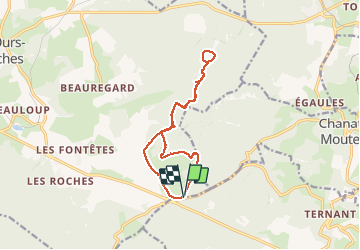

Length
13.6 km

Max alt
1157 m

Uphill gradient
437 m
Km-Effort
19.4 km

Min alt
949 m

Downhill gradient
438 m
Boucle
Yes
Creation date :
2019-09-12 07:11:17.551
Updated on :
2019-09-14 19:18:40.385
5h25
Difficulty : Easy

FREE GPS app for hiking
 SityTrail
IGN / Geographical institutes
SityTrail Plus
The world is yours!
About
Trail Walking of 13.6 km to be discovered at Auvergne-Rhône-Alpes, Puy-de-Dôme, Saint-Ours. This trail is proposed by jacq58.
Description
Randonnée agréable et facile à part la montée au puy des Goutte, grande partie de la randonnée en sous bois.
Photos


Positioning
Country:
France
Region :
Auvergne-Rhône-Alpes
Department/Province :
Puy-de-Dôme
Municipality :
Saint-Ours
Location:
Unknown
Start:(Dec)
Start:(UTM)
496750 ; 5073445 (31T) N.
Comments