


20110326-Mont Cauvaire

doudet
User
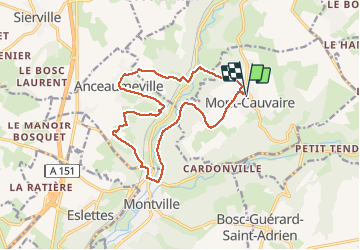

Length
14.2 km

Max alt
175 m

Uphill gradient
331 m
Km-Effort
18.6 km

Min alt
55 m

Downhill gradient
331 m
Boucle
Yes
Creation date :
2019-09-15 06:47:43.602
Updated on :
2019-09-15 06:47:43.602
--
Difficulty : Unknown

FREE GPS app for hiking
 SityTrail
IGN / Geographical institutes
SityTrail Plus
The world is yours!
About
Trail On foot of 14.2 km to be discovered at Normandy, Seine-Maritime, Mont-Cauvaire. This trail is proposed by doudet.
Positioning
Country:
France
Region :
Normandy
Department/Province :
Seine-Maritime
Municipality :
Mont-Cauvaire
Location:
Unknown
Start:(Dec)
Start:(UTM)
363189 ; 5492768 (31U) N.
Comments