


20111004-Le Cardonnet

doudet
User
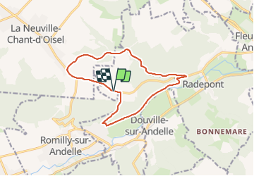

Length
12.5 km

Max alt
156 m

Uphill gradient
203 m
Km-Effort
15.3 km

Min alt
20 m

Downhill gradient
202 m
Boucle
Yes
Creation date :
2019-09-15 07:15:06.024
Updated on :
2019-09-15 07:15:06.024
--
Difficulty : Unknown

FREE GPS app for hiking
 SityTrail
IGN / Geographical institutes
SityTrail Plus
The world is yours!
About
Trail Walking of 12.5 km to be discovered at Normandy, Eure, Pont-Saint-Pierre. This trail is proposed by doudet.
Positioning
Country:
France
Region :
Normandy
Department/Province :
Eure
Municipality :
Pont-Saint-Pierre
Location:
Unknown
Start:(Dec)
Start:(UTM)
375215 ; 5467669 (31U) N.
Comments