


Rando Renards 2019

pascal.dabet
User

Length
42 km

Max alt
182 m

Uphill gradient
655 m
Km-Effort
50 km

Min alt
81 m

Downhill gradient
654 m
Boucle
Yes
Creation date :
2019-09-15 06:35:34.289
Updated on :
2019-09-15 10:50:32.993
4h13
Difficulty : Very easy

FREE GPS app for hiking
 SityTrail
IGN / Geographical institutes
SityTrail Plus
The world is yours!
About
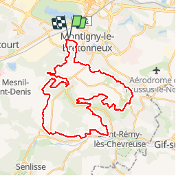
Trail Mountain bike of 42 km to be discovered at Ile-de-France, Yvelines, Montigny-le-Bretonneux. This trail is proposed by pascal.dabet.
Positioning
Country:
France
Region :
Ile-de-France
Department/Province :
Yvelines
Municipality :
Montigny-le-Bretonneux
Location:
Unknown
Start:(Dec)
Start:(UTM)
428031 ; 5402660 (31U) N.
Comments