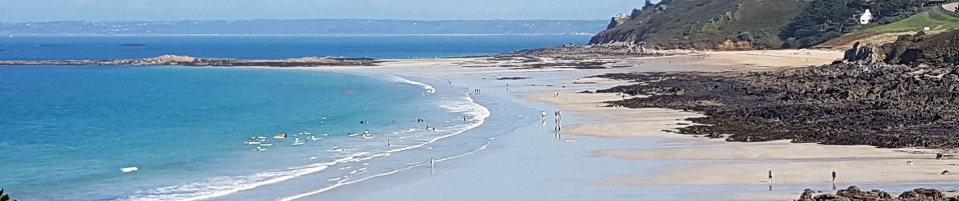
Locquirec. Moulin pont de la rive - toularvilain AR

ollivier.albert
User
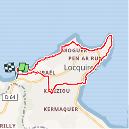

Length
7.7 km

Max alt
55 m

Uphill gradient
147 m
Km-Effort
9.7 km

Min alt
0 m

Downhill gradient
147 m
Boucle
Yes
Creation date :
2019-09-15 12:20:19.624
Updated on :
2019-09-15 17:20:15.83
2h18
Difficulty : Difficult

FREE GPS app for hiking
 SityTrail
IGN / Geographical institutes
SityTrail Plus
The world is yours!
About
Trail Walking of 7.7 km to be discovered at Brittany, Finistère, Locquirec. This trail is proposed by ollivier.albert.
Photos


Positioning
Country:
France
Region :
Brittany
Department/Province :
Finistère
Municipality :
Locquirec
Location:
Unknown
Start:(Dec)
Start:(UTM)
450242 ; 5392868 (30U) N.
Comments