


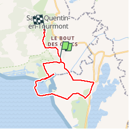
La Maye

liebniz
User

Length
12.3 km

Max alt
13 m

Uphill gradient
46 m
Km-Effort
13 km

Min alt
-1 m

Downhill gradient
50 m
Boucle
No
Creation date :
2019-09-15 14:51:44.0
Updated on :
2019-09-18 14:17:42.263
2h43
Difficulty : Unknown

FREE GPS app for hiking
 SityTrail
IGN / Geographical institutes
SityTrail Plus
The world is yours!
About
Trail Horseback riding of 12.3 km to be discovered at Hauts-de-France, Somme, Saint-Quentin-en-Tourmont. This trail is proposed by liebniz.
Description
Ne peut etre fait qu'a marée basse puisqu'il faut traverser la maye
Positioning
Country:
France
Region :
Hauts-de-France
Department/Province :
Somme
Municipality :
Saint-Quentin-en-Tourmont
Location:
Unknown
Start:(Dec)
Start:(UTM)
400151 ; 5569058 (31U) N.
Comments
ATTENTION une partie du circuit traverse la réserve naturelle nationale de baie de Somme avec sa réglementation propre notamment l'interdiction des chiens toute l'année et interdiction de déranger la faune