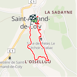
Trail Walking Coly-Saint-Amand - Saint Amand de Coly  - Photo
© OpenStreetMap contributors
Length
Length
1.6 km
Max alt
Max alt
241 m
Uphill gradient
Uphill gradient
60 m
Km-Effort
Km-Effort  
2.4 km
Min alt
Min alt
171 m
Downhill gradient
Downhill gradient
64 m
Boucle
Boucle
Yes
Creation date :
2019-09-14 07:56:04.875
Updated on :
2019-09-16 09:46:42.695

(0 Reviews)

Walking
Walking
1h17
Difficulty : Easy

Scan this QR Code to open this trail in the SityTrail application

FREE GPS app for hiking

Logo SityTrail SityTrail

IGN / Geographical institutes

Download SityTrail from the App Store Download SityTrail from Google Play

Logo SityTrail SityTrail Plus

The world is yours!

Download SityTrail from the App Store Download SityTrail from Google Play Download SityTrail on Huawei AppGallery

About

Trail Walking of 1.6 km to be discovered at New Aquitaine, Dordogne, Coly-Saint-Amand. This trail is proposed by alainjoseph6.

Description

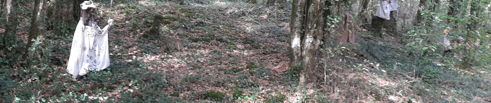
un village magnifique avec son sentier d'interprétation et dans majestueuse Abbaye.
Saint Amand de Coly fait partie des plus beaux villages de France .
Il faut se garer au parking en bas du village.

Elevation profile

Photos

Positioning

Country:
France
Region :
New Aquitaine
Department/Province :
Dordogne
Municipality :
Coly-Saint-Amand
Location:
Unknown
Start:(UTM)
361948 ; 4991454 (31T) N.


Close
My subscriptions