


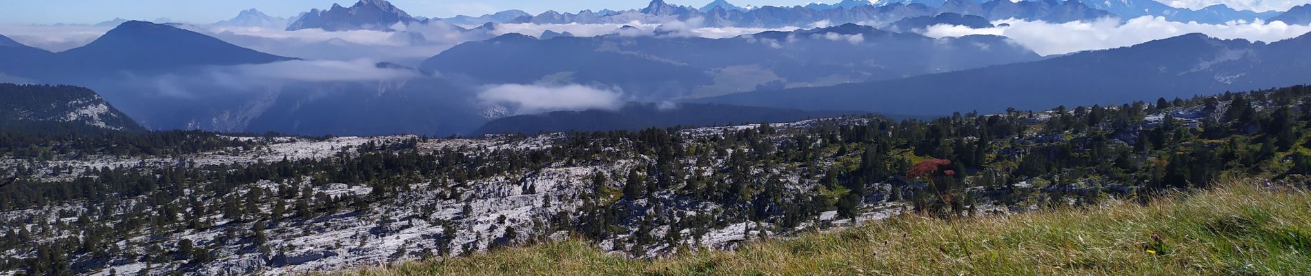
la tête du Parmeka

begnez
User
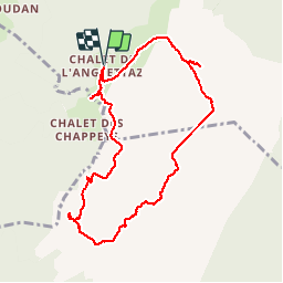

Length
9.2 km

Max alt
1826 m

Uphill gradient
416 m
Km-Effort
14.7 km

Min alt
1490 m

Downhill gradient
417 m
Boucle
Yes
Creation date :
2019-09-19 07:20:00.153
Updated on :
2019-09-19 13:49:04.895
5h15
Difficulty : Medium

FREE GPS app for hiking
 SityTrail
IGN / Geographical institutes
SityTrail Plus
The world is yours!
About
Trail Walking of 9.2 km to be discovered at Auvergne-Rhône-Alpes, Upper Savoy, Fillière. This trail is proposed by begnez.
Photos


Positioning
Country:
France
Region :
Auvergne-Rhône-Alpes
Department/Province :
Upper Savoy
Municipality :
Fillière
Location:
Aviernoz
Start:(Dec)
Start:(UTM)
286439 ; 5093763 (32T) N.
Comments