


brénas

pipette12
User

Length
16.4 km

Max alt
679 m

Uphill gradient
624 m
Km-Effort
25 km

Min alt
217 m

Downhill gradient
628 m
Boucle
Yes
Creation date :
2014-12-10 00:00:00.0
Updated on :
2014-12-10 00:00:00.0
5h14
Difficulty : Very easy

FREE GPS app for hiking
 SityTrail
IGN / Geographical institutes
SityTrail Plus
The world is yours!
About
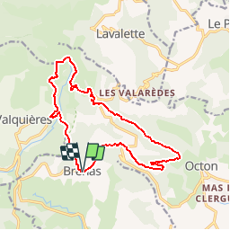
Trail Walking of 16.4 km to be discovered at Occitania, Hérault, Brenas. This trail is proposed by pipette12.
Description
circuit de brénas
Positioning
Country:
France
Region :
Occitania
Department/Province :
Hérault
Municipality :
Brenas
Location:
Unknown
Start:(Dec)
Start:(UTM)
520742 ; 4833374 (31T) N.
Comments