


Fagne de l' Abîme Croix Scaille Gedinne

ramagufa
User

Length
7.6 km

Max alt
511 m

Uphill gradient
161 m
Km-Effort
9.8 km

Min alt
384 m

Downhill gradient
163 m
Boucle
Yes
Creation date :
2019-09-20 19:22:41.187
Updated on :
2019-09-20 19:30:58.132
2h05
Difficulty : Very easy

FREE GPS app for hiking
 SityTrail
IGN / Geographical institutes
SityTrail Plus
The world is yours!
About
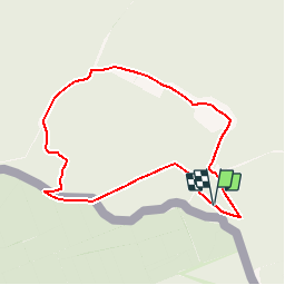
Trail Walking of 7.6 km to be discovered at Wallonia, Namur, Gedinne. This trail is proposed by ramagufa.
Description
Un petit tour de la Croix Scaille à la Fagne l'Abîme (7,6 km) avant de prendre la rando des monts d'Ardenne (224 km).
Positioning
Country:
Belgium
Region :
Wallonia
Department/Province :
Namur
Municipality :
Gedinne
Location:
Bourseigne-Neuve
Start:(Dec)
Start:(UTM)
632394 ; 5534810 (31U) N.
Comments
Dommage pour vous. Espérons qu’ils entretiennent de nouveau. Car elle est plaisante à faire sans difficulté. Je referai dans qqes semaines
Une portion pas entretenue où la nature a repris ses droits… mais agréable à faire
début très sympa, arrivé à la moitié nous sommes arrivés sur des chemins qui n'étaient plus entretenus et pas du tout au niveau de la personne qui m'accompagnait qui a des problèmes de mobilité (la promenade était normalement facile)