


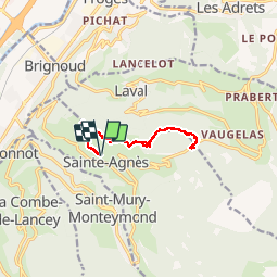
Sainte Agnès vers le col des mouilles

sandra_leb
User

Length
10.8 km

Max alt
1040 m

Uphill gradient
456 m
Km-Effort
16.9 km

Min alt
715 m

Downhill gradient
458 m
Boucle
Yes
Creation date :
2019-09-22 09:16:48.0
Updated on :
2019-09-24 10:08:38.29
2h48
Difficulty : Medium

FREE GPS app for hiking
 SityTrail
IGN / Geographical institutes
SityTrail Plus
The world is yours!
About
Trail Walking of 10.8 km to be discovered at Auvergne-Rhône-Alpes, Isère, Sainte-Agnès. This trail is proposed by sandra_leb.
Description
Petite randonnée bien sympathique qui permet sur le dome de la Croix Sainte Agnes d'avoir une vue a 360° absolumetn magnifique
Positioning
Country:
France
Region :
Auvergne-Rhône-Alpes
Department/Province :
Isère
Municipality :
Sainte-Agnès
Location:
Unknown
Start:(Dec)
Start:(UTM)
729456 ; 5013527 (31T) N.
Comments