


bioul

berger64
User
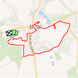

Length
4.2 km

Max alt
240 m

Uphill gradient
53 m
Km-Effort
4.9 km

Min alt
212 m

Downhill gradient
56 m
Boucle
Yes
Creation date :
2019-09-22 12:22:51.884
Updated on :
2019-09-22 14:21:35.296
1h58
Difficulty : Very easy

FREE GPS app for hiking
 SityTrail
IGN / Geographical institutes
SityTrail Plus
The world is yours!
About
Trail Walking of 4.2 km to be discovered at Wallonia, Namur, Anhée. This trail is proposed by berger64.
Description
Bioul maredsous
Positioning
Country:
Belgium
Region :
Wallonia
Department/Province :
Namur
Municipality :
Anhée
Location:
Bioul
Start:(Dec)
Start:(UTM)
627444 ; 5577002 (31U) N.
Comments