


boucle Salese-Adus-Archas

ch2slv
User
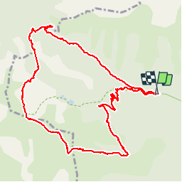

Length
13.5 km

Max alt
2511 m

Uphill gradient
848 m
Km-Effort
25 km

Min alt
1675 m

Downhill gradient
860 m
Boucle
Yes
Creation date :
2015-06-23 00:00:00.0
Updated on :
2015-06-23 00:00:00.0
5h06
Difficulty : Difficult

FREE GPS app for hiking
 SityTrail
IGN / Geographical institutes
SityTrail Plus
The world is yours!
About
Trail Walking of 13.5 km to be discovered at Provence-Alpes-Côte d'Azur, Maritime Alps, Saint-Martin-Vésubie. This trail is proposed by ch2slv.
Description
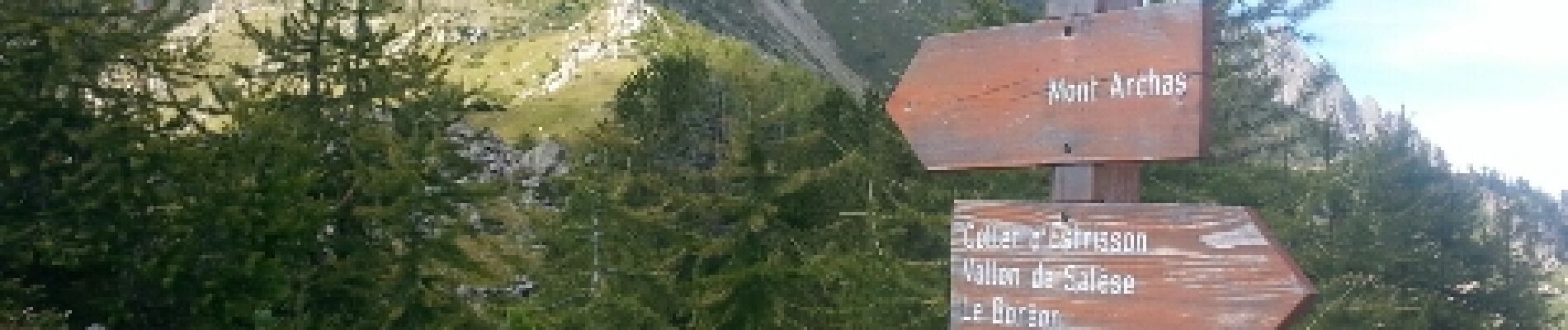
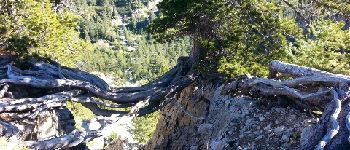
850m très variés. Sous-bois, champs de rhododendrons, pierriers et au sommet tout le Mercantour d un côté, St Martin, Molieres et l Argentera de l autre
Photos


Positioning
Country:
France
Region :
Provence-Alpes-Côte d'Azur
Department/Province :
Maritime Alps
Municipality :
Saint-Martin-Vésubie
Location:
Unknown
Start:(Dec)
Start:(UTM)
360825 ; 4887334 (32T) N.
Comments