olivier26

olivier26
User

Length
10.2 km

Max alt
414 m

Uphill gradient
326 m
Km-Effort
14.6 km

Min alt
172 m

Downhill gradient
326 m
Boucle
Yes
Creation date :
2014-12-10 00:00:00.0
Updated on :
2014-12-10 00:00:00.0
2h08
Difficulty : Easy

FREE GPS app for hiking
 SityTrail
IGN / Geographical institutes
SityTrail Plus
The world is yours!
About
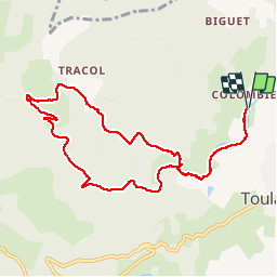
Trail Walking of 10.2 km to be discovered at Auvergne-Rhône-Alpes, Ardèche, Toulaud. This trail is proposed by olivier26.
Description
randonnée à pieds et une petite partie en courant.
Positioning
Country:
France
Region :
Auvergne-Rhône-Alpes
Department/Province :
Ardèche
Municipality :
Toulaud
Location:
Unknown
Start:(Dec)
Start:(UTM)
643151 ; 4974326 (31T) N.
Comments