


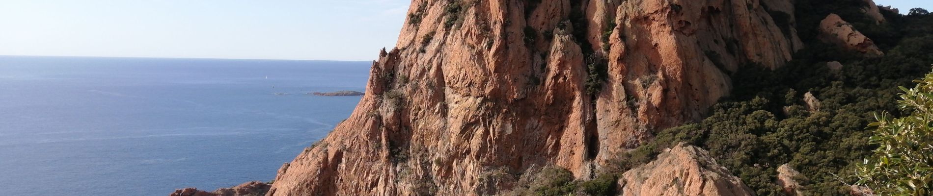
du cap Roux au pic du cap Roux

jnpollet
User
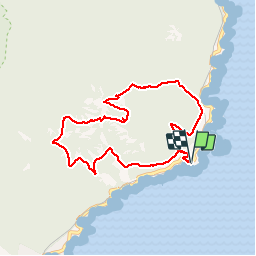

Length
8.5 km

Max alt
440 m

Uphill gradient
454 m
Km-Effort
14.6 km

Min alt
28 m

Downhill gradient
452 m
Boucle
Yes
Creation date :
2019-09-26 07:55:19.161
Updated on :
2019-09-26 10:49:30.452
2h53
Difficulty : Medium

FREE GPS app for hiking
 SityTrail
IGN / Geographical institutes
SityTrail Plus
The world is yours!
About
Trail Walking of 8.5 km to be discovered at Provence-Alpes-Côte d'Azur, Var, Saint-Raphaël. This trail is proposed by jnpollet.
Description
Attention le retour effectué n'est pas balisé ni entretenu
Photos


Positioning
Country:
France
Region :
Provence-Alpes-Côte d'Azur
Department/Province :
Var
Municipality :
Saint-Raphaël
Location:
Unknown
Start:(Dec)
Start:(UTM)
331514 ; 4812801 (32T) N.
Comments