


tour du courradour

PEBREJOSIANE
User
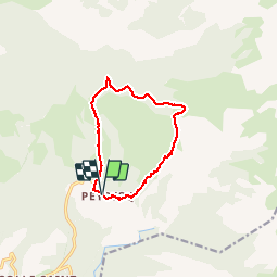

Length
10.9 km

Max alt
2145 m

Uphill gradient
630 m
Km-Effort
19.3 km

Min alt
1514 m

Downhill gradient
634 m
Boucle
Yes
Creation date :
2019-09-26 08:15:34.506
Updated on :
2019-09-26 18:00:55.919
5h35
Difficulty : Easy

FREE GPS app for hiking
 SityTrail
IGN / Geographical institutes
SityTrail Plus
The world is yours!
About
Trail Walking of 10.9 km to be discovered at Provence-Alpes-Côte d'Azur, Alpes-de-Haute-Provence, Thorame-Haute. This trail is proposed by PEBREJOSIANE.
Positioning
Country:
France
Region :
Provence-Alpes-Côte d'Azur
Department/Province :
Alpes-de-Haute-Provence
Municipality :
Thorame-Haute
Location:
Unknown
Start:(Dec)
Start:(UTM)
309124 ; 4882209 (32T) N.
Comments