


pic negre

albaultjl
User
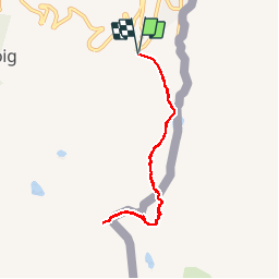

Length
7.6 km

Max alt
2792 m

Uphill gradient
582 m
Km-Effort
15.3 km

Min alt
2217 m

Downhill gradient
582 m
Boucle
Yes
Creation date :
2019-09-28 07:30:44.519
Updated on :
2019-09-28 14:41:43.802
5h21
Difficulty : Easy

FREE GPS app for hiking
 SityTrail
IGN / Geographical institutes
SityTrail Plus
The world is yours!
About
Trail Walking of 7.6 km to be discovered at Andorra. This trail is proposed by albaultjl.
Positioning
Country:
Andorra
Region :
Unknown
Department/Province :
Unknown
Municipality :
Unknown
Location:
Unknown
Start:(Dec)
Start:(UTM)
395471 ; 4710193 (31T) N.
Comments