


rando des mémères by phiphidechagny

phiphidechagny
User
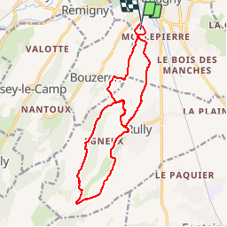

Length
16.3 km

Max alt
365 m

Uphill gradient
376 m
Km-Effort
21 km

Min alt
216 m

Downhill gradient
379 m
Boucle
Yes
Creation date :
2019-09-29 11:37:50.567
Updated on :
2019-09-29 13:19:23.818
1h41
Difficulty : Easy

FREE GPS app for hiking
 SityTrail
IGN / Geographical institutes
SityTrail Plus
The world is yours!
About
Trail Mountain bike of 16.3 km to be discovered at Bourgogne-Franche-Comté, Saône-et-Loire, Chagny. This trail is proposed by phiphidechagny.
Description
sympa les mémères !!!
Positioning
Country:
France
Region :
Bourgogne-Franche-Comté
Department/Province :
Saône-et-Loire
Municipality :
Chagny
Location:
Unknown
Start:(Dec)
Start:(UTM)
632842 ; 5195803 (31T) N.
Comments