


Pyrénées jour 4

dudu85
User
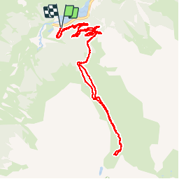

Length
12.6 km

Max alt
1875 m

Uphill gradient
716 m
Km-Effort
22 km

Min alt
1172 m

Downhill gradient
709 m
Boucle
Yes
Creation date :
2019-10-04 07:40:48.0
Updated on :
2019-10-04 13:52:17.14
4h06
Difficulty : Unknown

FREE GPS app for hiking
 SityTrail
IGN / Geographical institutes
SityTrail Plus
The world is yours!
About
Trail Walking of 12.6 km to be discovered at Occitania, Hautespyrenees, Estaing. This trail is proposed by dudu85.
Description
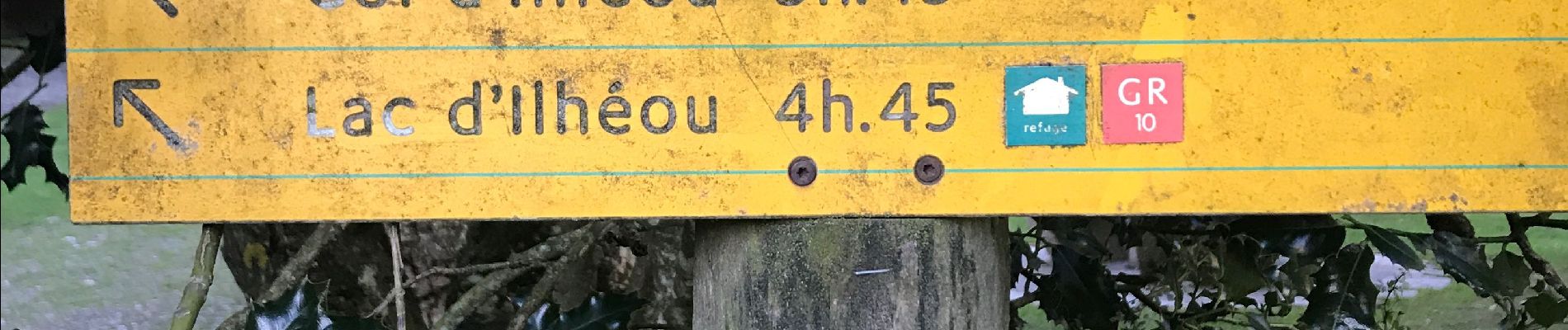
A.R Départ Lac d’Estaing - Cabanes de Barbât... Dénivelé 1877m
Photos


Positioning
Country:
France
Region :
Occitania
Department/Province :
Hautespyrenees
Municipality :
Estaing
Location:
Unknown
Start:(Dec)
Start:(UTM)
727702 ; 4753992 (30T) N.
Comments