


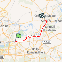
De Lagny-sur-Marne à Meaux

NUITEVEN
User

Length
21 km

Max alt
85 m

Uphill gradient
174 m
Km-Effort
23 km

Min alt
37 m

Downhill gradient
167 m
Boucle
No
Creation date :
2019-10-06 14:20:58.054
Updated on :
2019-11-11 11:44:18.997
5h06
Difficulty : Very difficult

FREE GPS app for hiking
 SityTrail
IGN / Geographical institutes
SityTrail Plus
The world is yours!
About
Trail Walking of 21 km to be discovered at Ile-de-France, Seine-et-Marne, Thorigny-sur-Marne. This trail is proposed by NUITEVEN.
Positioning
Country:
France
Region :
Ile-de-France
Department/Province :
Seine-et-Marne
Municipality :
Thorigny-sur-Marne
Location:
Unknown
Start:(Dec)
Start:(UTM)
478312 ; 5414350 (31U) N.
Comments