


Lac de Tavels en boucle au départ Isola

PEBREJOSIANE
User
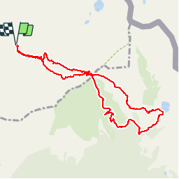

Length
10.4 km

Max alt
2347 m

Uphill gradient
578 m
Km-Effort
18.1 km

Min alt
2071 m

Downhill gradient
578 m
Boucle
Yes
Creation date :
2019-10-10 07:52:10.849
Updated on :
2019-10-10 14:49:46.453
5h48
Difficulty : Easy

FREE GPS app for hiking
 SityTrail
IGN / Geographical institutes
SityTrail Plus
The world is yours!
About
Trail Walking of 10.4 km to be discovered at Provence-Alpes-Côte d'Azur, Maritime Alps, Isola. This trail is proposed by PEBREJOSIANE.
Positioning
Country:
France
Region :
Provence-Alpes-Côte d'Azur
Department/Province :
Maritime Alps
Municipality :
Isola
Location:
Unknown
Start:(Dec)
Start:(UTM)
353379 ; 4893829 (32T) N.
Comments