


10102019

jacquesduchesne
User
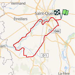

Length
54 km

Max alt
125 m

Uphill gradient
392 m
Km-Effort
60 km

Min alt
61 m

Downhill gradient
392 m
Boucle
Yes
Creation date :
2019-10-10 11:54:06.988
Updated on :
2019-10-12 12:20:37.567
2h37
Difficulty : Very easy

FREE GPS app for hiking
 SityTrail
IGN / Geographical institutes
SityTrail Plus
The world is yours!
About
Trail Bicycle tourism of 54 km to be discovered at Hauts-de-France, Aisne, Mesnil-Saint-Laurent. This trail is proposed by jacquesduchesne.
Positioning
Country:
France
Region :
Hauts-de-France
Department/Province :
Aisne
Municipality :
Mesnil-Saint-Laurent
Location:
Unknown
Start:(Dec)
Start:(UTM)
525466 ; 5519665 (31U) N.
Comments