


Rando Le Cimet

trailer.nono
User

Length
16.5 km

Max alt
3007 m

Uphill gradient
1178 m
Km-Effort
32 km

Min alt
2059 m

Downhill gradient
1178 m
Boucle
Yes
Creation date :
2019-10-13 06:58:22.848
Updated on :
2019-10-13 19:29:58.006
5h07
Difficulty : Easy

FREE GPS app for hiking
 SityTrail
IGN / Geographical institutes
SityTrail Plus
The world is yours!
About
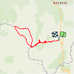
Trail Walking of 16.5 km to be discovered at Provence-Alpes-Côte d'Azur, Alpes-de-Haute-Provence, Uvernet-Fours. This trail is proposed by trailer.nono.
Positioning
Country:
France
Region :
Provence-Alpes-Côte d'Azur
Department/Province :
Alpes-de-Haute-Provence
Municipality :
Uvernet-Fours
Location:
Unknown
Start:(Dec)
Start:(UTM)
319763 ; 4905442 (32T) N.
Comments