


VALLEE DE LA MARNE

NUITEVEN
User

Length
19.8 km

Max alt
85 m

Uphill gradient
170 m
Km-Effort
22 km

Min alt
37 m

Downhill gradient
166 m
Boucle
No
Creation date :
2014-12-10 00:00:00.0
Updated on :
2014-12-10 00:00:00.0
4h57
Difficulty : Easy

FREE GPS app for hiking
 SityTrail
IGN / Geographical institutes
SityTrail Plus
The world is yours!
About
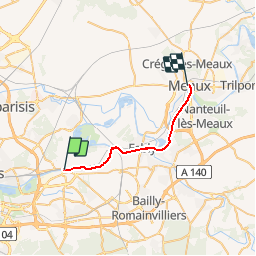
Trail Walking of 19.8 km to be discovered at Ile-de-France, Seine-et-Marne, Pomponne. This trail is proposed by NUITEVEN.
Positioning
Country:
France
Region :
Ile-de-France
Department/Province :
Seine-et-Marne
Municipality :
Pomponne
Location:
Unknown
Start:(Dec)
Start:(UTM)
478318 ; 5414333 (31U) N.
Comments
excellent