


Baisse du Basto

bozo1970
User

Length
17.8 km

Max alt
2698 m

Uphill gradient
1505 m
Km-Effort
38 km

Min alt
1684 m

Downhill gradient
1508 m
Boucle
Yes
Creation date :
2019-10-17 07:17:20.0
Updated on :
2019-10-17 18:20:56.509
7h19
Difficulty :

FREE GPS app for hiking
 SityTrail
IGN / Geographical institutes
SityTrail Plus
The world is yours!
About
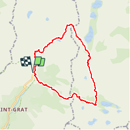
Trail Walking of 17.8 km to be discovered at Provence-Alpes-Côte d'Azur, Maritime Alps, Belvédère. This trail is proposed by bozo1970.
Description
Lac Autier— Baisse du Basto— Baisse de Valmasque — Pas de l’Arpette
1500 m de D
17,8 km
7h20’
Difficile
Positioning
Country:
France
Region :
Provence-Alpes-Côte d'Azur
Department/Province :
Maritime Alps
Municipality :
Belvédère
Location:
Unknown
Start:(Dec)
Start:(UTM)
371885 ; 4881322 (32T) N.
Comments