Trail Other activity Bregaglia - Promontogno - Soglio - Photo

Promontogno - Soglio

 hallauer
hallauer

User

© OpenStreetMap contributors
Length
Length
33 km
Max alt
Max alt
2707 m
Uphill gradient
Uphill gradient
2246 m
Km-Effort
Km-Effort  
62 km
Min alt
Min alt
1037 m
Downhill gradient
Downhill gradient
2229 m
Boucle
Boucle
Yes
Creation date :
2014-12-11 00:00:00.0
Updated on :
2014-12-11 00:00:00.0

(0 Reviews)

Other activity
Other activity
--
Difficulty : Unknown

Scan this QR Code to open this trail in the SityTrail application

FREE GPS app for hiking

Logo SityTrail SityTrail

IGN / Geographical institutes

Download SityTrail from the App Store Download SityTrail from Google Play

Logo SityTrail SityTrail World

The world is yours!

Download SityTrail from the App Store Download SityTrail from Google Play Download SityTrail on Huawei AppGallery

About

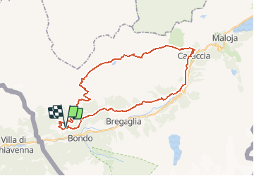
Trail Other activity of 33 km to be discovered at Grisons, Maloja, Bregaglia. This trail is proposed by hallauer.

Description

Letzte Tagesetappe aus unserem Sommerprogramm "von Amsteg über den Gotthard"

Elevation profile

Positioning

Country:
Switzerland
Region :
Grisons
Department/Province :
Maloja
Municipality :
Bregaglia
Location:
Unknown
Start:(UTM)
541613 ; 5132127 (32T) N.

Trails nearby

Trail Other activity Bregaglia - Capanna Sciora - Photo
Other activity
pnoth

Other activity

Very easy
Bregaglia, Grisons, Maloja, Switzerland
3.1 km | 11.1 km-effort
Unknown
No


Close
My subscriptions