


Treffendel

nolsim
User
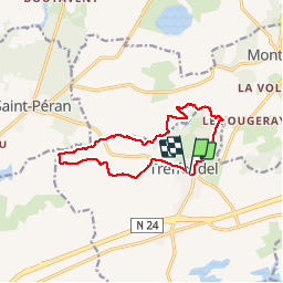

Length
11.6 km

Max alt
136 m

Uphill gradient
179 m
Km-Effort
14 km

Min alt
63 m

Downhill gradient
179 m
Boucle
Yes
Creation date :
2019-10-24 12:17:49.77
Updated on :
2019-10-24 15:07:01.321
2h44
Difficulty : Medium

FREE GPS app for hiking
 SityTrail
IGN / Geographical institutes
SityTrail Plus
The world is yours!
About
Trail Walking of 11.6 km to be discovered at Brittany, Ille-et-Vilaine, Treffendel. This trail is proposed by nolsim.
Description
belle rando le long du Serein
Positioning
Country:
France
Region :
Brittany
Department/Province :
Ille-et-Vilaine
Municipality :
Treffendel
Location:
Unknown
Start:(Dec)
Start:(UTM)
573978 ; 5321254 (30U) N.
Comments